 |
 |
 |
 |
|
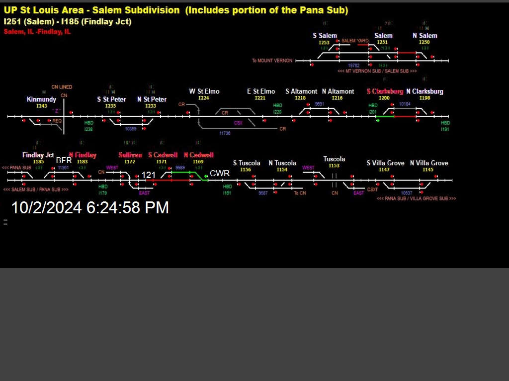
Disclaimer: Never base important decisions on the information from this page. For indication only. Union Pacific Rail Road Pana Subdivision. Controls from S. Clarksburg and S. Findlay to N. Villa Grove, IL. Indications from S. Clarksburg and S. Findlay to N. Cadwell only. Updates normally every 5 minutes. An explanation of this
information follows: Modern rail controls consist of a Base Control
Point and a Mobile Control Point that communicate information using radio
waves about a
particular rail route. A monitoring station has been set up to convert
the data on the radio to data seen in the map above. The map above shows track segments from south on
the top left to north on the lower right.
Active text is used to show/display the following: |
|
| -------- | Indicates length of track occupied by a train. |
| -------- | Indicates length of track cleared for a train to proceed (accompanied by a green control light). |
| N Tuscola | A green station name indicates a particular station is being monitored for data packets. |
| N Villa Grove | A blue station name indicates a control has been sent from the base station to this station in the field but the station in the field is out of monitoring range or has not responded to the request from the base. |
|
S Findlay |
A red station name indicates a control has been sent from the base to this particular station in the field and the this station has sent back a packet indicating it has responded to the request from the base. |